This post probably contains affiliate links. This means that you still pay the same price, but we earn a small commission. As an Amazon Associate, we earn from qualifying purchases. We only ever link products that we have tried and can recommend with confidence. These items are Nirvana Girl approved! We always appreciate your support in our journey!
This past summer I did my third mutli-day trip, hiking the Tonquin Valley, in Jasper Alberta. After much research I decided to plan one of my “bucket list trips”. Funny enough the original plan was to do it a year earlier, but the Parks Canada reservation system is a struggle. By the time I queued up on the appropriate day, was assigned a random place in the virtual queue, and got in, the campsites were all full for all the variations of the itenerary I wanted on the days I could go! So one year later here we are.
Bookings:
Bookings for Tonquin Valley opened in January, and I was up at 7:00 AM the day bookings opened in order to secure a permit. You can check the Parks Canada site for the specific day it opens as it may change from year to year. Tonquin Valley is one of the most popular trails in Jasper, and people come from international destinations to hike it. We had 4 different people on 4 different laptops all trying to line up and get sites. Christy was helping me, my brother Brennan pitched in, and my friend Holly was working on it from her computer at work! (I think she even had her boss helping too!) We had a google document shared with all the trips, sites, and iteneraries we had planned! It was a tactial effort, but lo and behold we were able to pull it off!
Getting to the trailhead:
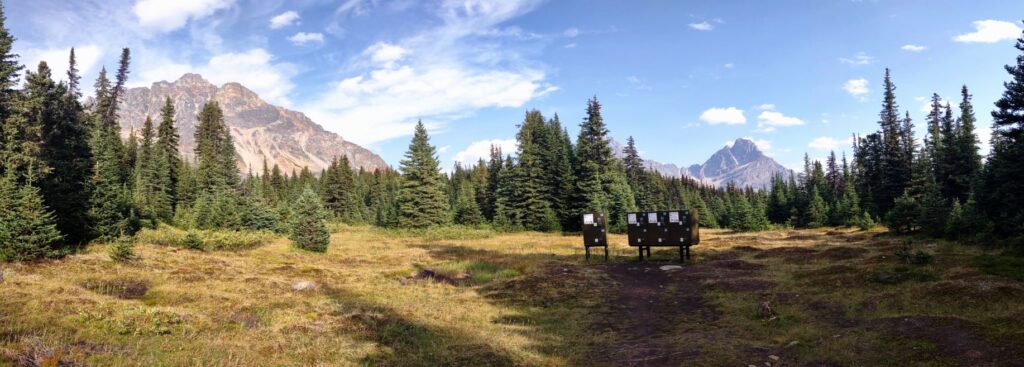
The Tonquin Valley trail is not a loop, and as far as I know there’s no handy shuttle to take you to the start of the hike. Now we live in the Edmonton area, which means we decided to drive down in two cars. Mom and my brother were kind enough to caravan down with Holly and I and they shuttled us to the higher trailhead. They then enjoyed a day hike in the area and took the dogs to the lake! We parked Holly’s car at the lower trailhead, Portal creek with the park pass inside. Please note when you make your reservation to put the license plate of the vehicle you are parking! This helps park staff verify things in case a car gets left longer than it should be.
Starting at the top:
We chose to start the hike from the “top” Astoria trailhead because that is the direction with less uphill hiking. Now don’t get me wrong, you are going up and down mountains, and there’s still plenty of uphill, but we figured it might be easier. But after doing this hike I have an alternate itenerary I’ll share at the bottom that I think I would prefer. It has the bonus of starting and ending at the same trailhead!
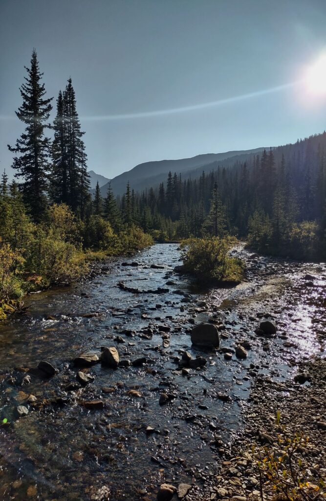
The first bit of the hike is really picturesque as you hike along the Astoria river, with some treed sections and some views of the moutains along the valley. We passed Astoria campground which was very lovely. One odd note on that campground, you have to climb up a really steep little 6ish foot hill to get up and down, and you have to climb down for the bear lockers and water, but the picnic tables are at the top. So remeber that if you decide to camp there!
Campground Number One – Switchback
Now comes the rough bit, we really should have known better. We were hiking up to Switchback campground. The name really does say it all LOL. A little while after Astoria campground is where the grind begins. There’s a really ridiculous number of switchbacks up the side of the mountian. You cross back and forth over an old rockslide several times, which was actually kind of fun the first time. After what felt like a couple hours of switchbacks you clear the treeline finally and get some nice views again. A short hike along the treeline brings you to the sign for Switchback campground! Then you have to hike in a bit to get there. Bear lockers are the first thing you see, then the tent pads, then the tables. So again keep that in mind when you unload!
The water source for this campground was a very shallow little creek off to the right side if you are facing the picnic tables. Not bad all said and done, but it might be tricky if you have a drier season. We unpacked, set up the tent, and had a lovely dinner of Kathmandu Curry from Backpackers Pantry. We made some hot apple cider, ate some chocolate, and crashed for the night.
Day Two
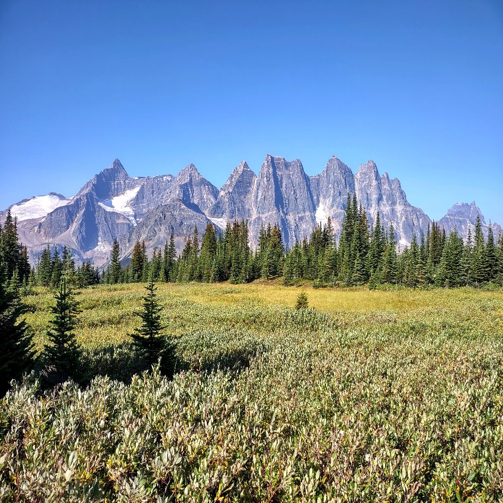
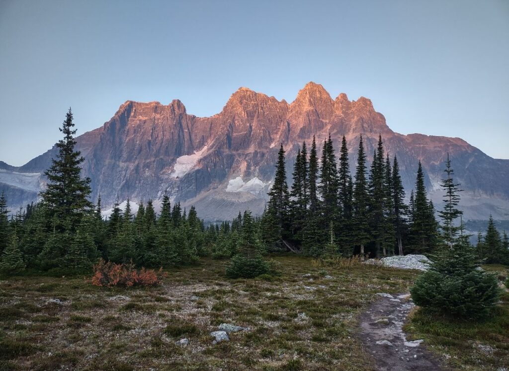
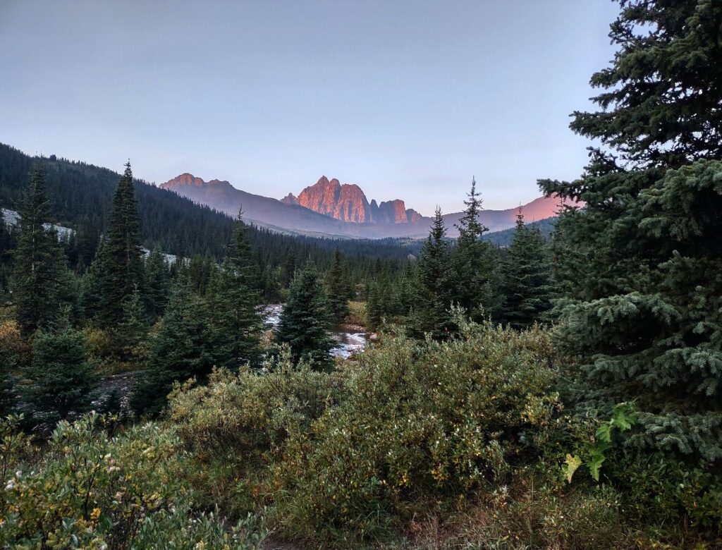
Day two we had planned to be super short and chill. We had about 6 KM to our next campground and the start of some really gorgeous views. We were hiking in and out of the trees making our way towards the Ramparts. They are a really spectacular view even from a distance.
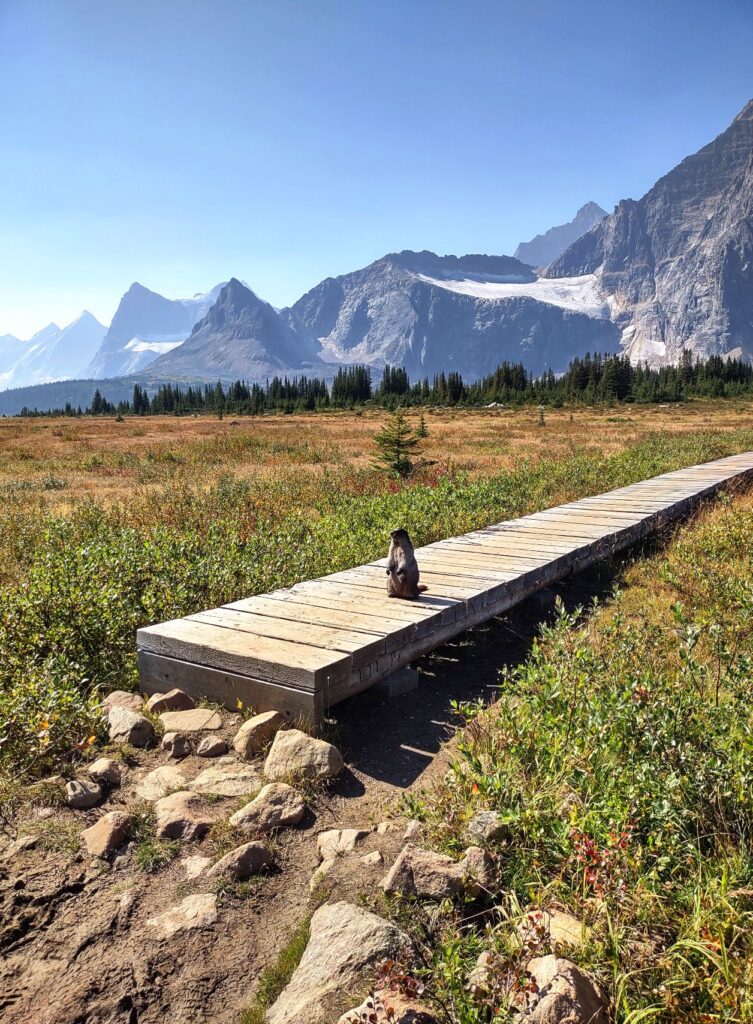
We hopped over a few creeks, enjoyed views of distant lakes and made our way to a clearing. We stopped in front of a boardwalk where a huge, chunky, totally unafraid Marmot was chilling. He came right up to us and stood on his hind legs. Eventually we had to shoo him off the boardwalk so we could cross.
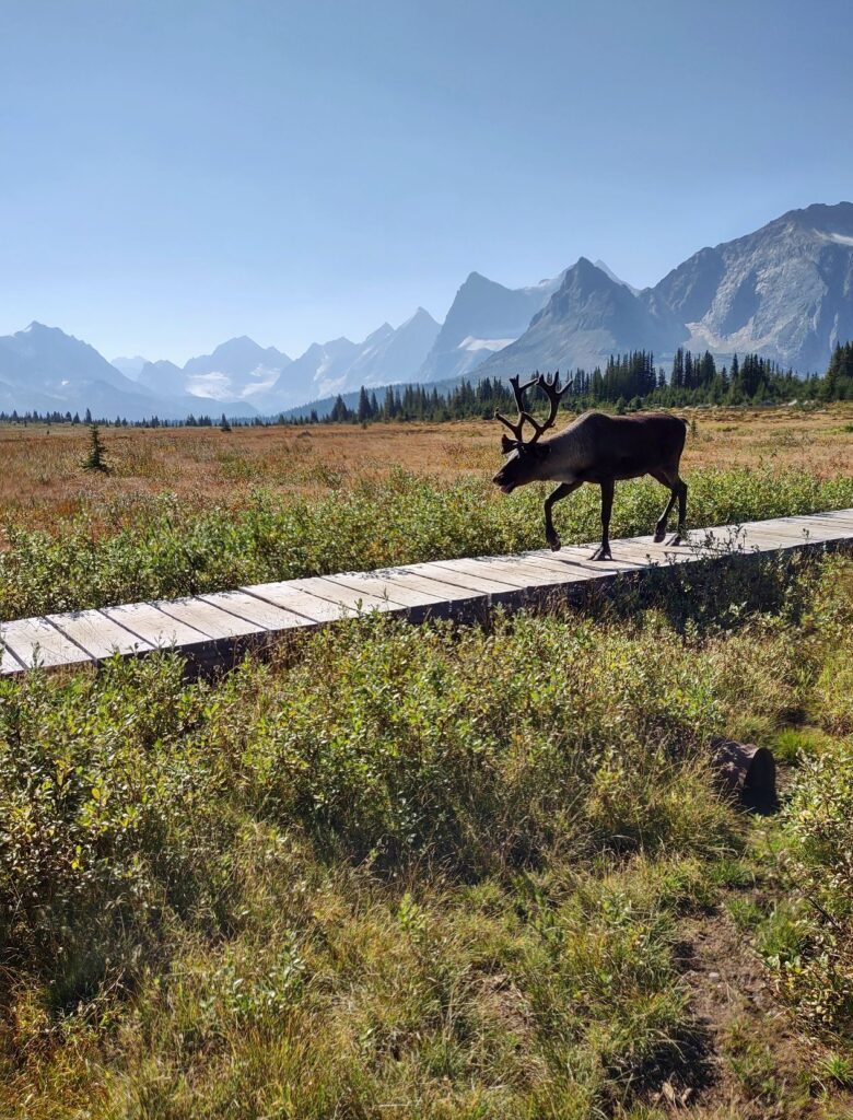
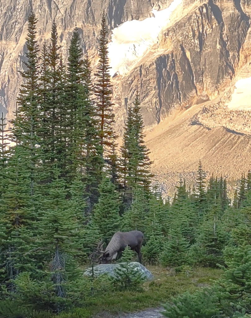
We started across and got about half way before we noticed something in the distance on the other end. We watched as it came closer and realized it was a caribou! We actually had to hop off the boardwalk and back up a few feet. (Always give all wild animals plenty of room.) We watched and filed as the caribou trotted past us! Then we hopped back on and crossed the rest of the way.
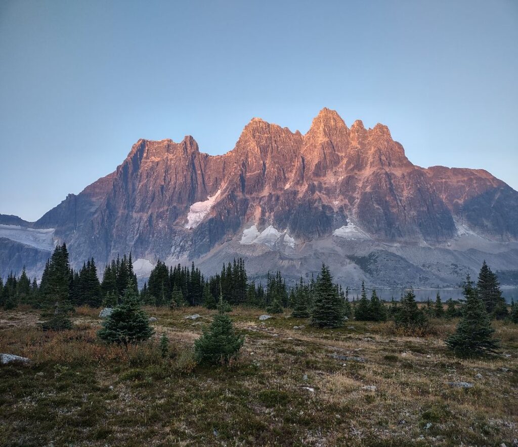
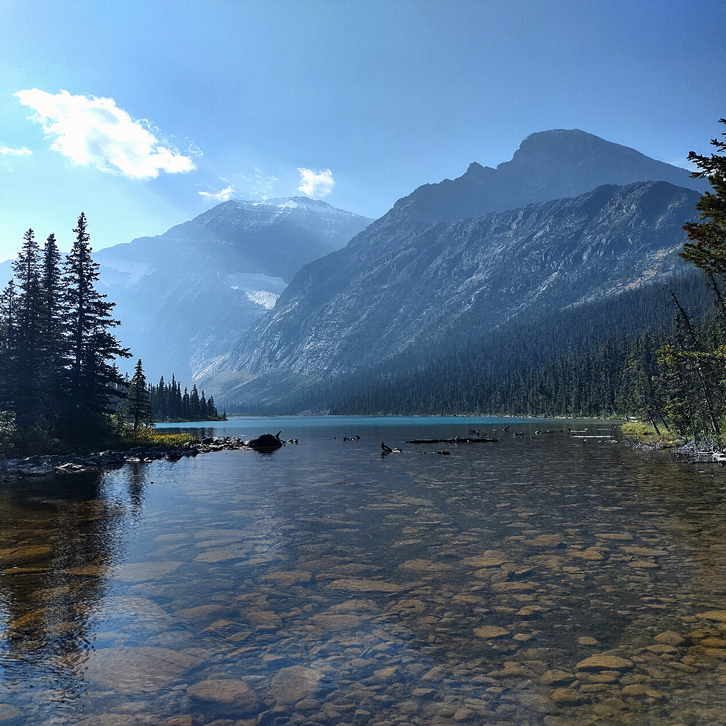
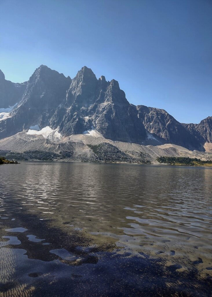
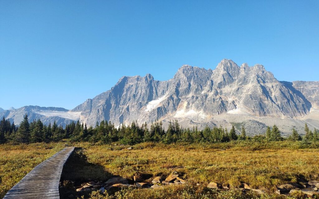
Campground Number Three – Amythest Lake
This campground was hailed as having the best views, most scenic, most amazing campground of Tonquin Valley. I have to say it did not disapoint. When you reach the sign for the campground the lake and the ramparts are on the left. To the right is the eating area and bear lockers. This is one of the bigger campgrounds we have statyed at with 8 tent pads. A little further down the trail from the eating area the tent pads start. We unloaded, had lunch, and picked a tent pad to set up the tent. Then we made our way down to the lake.
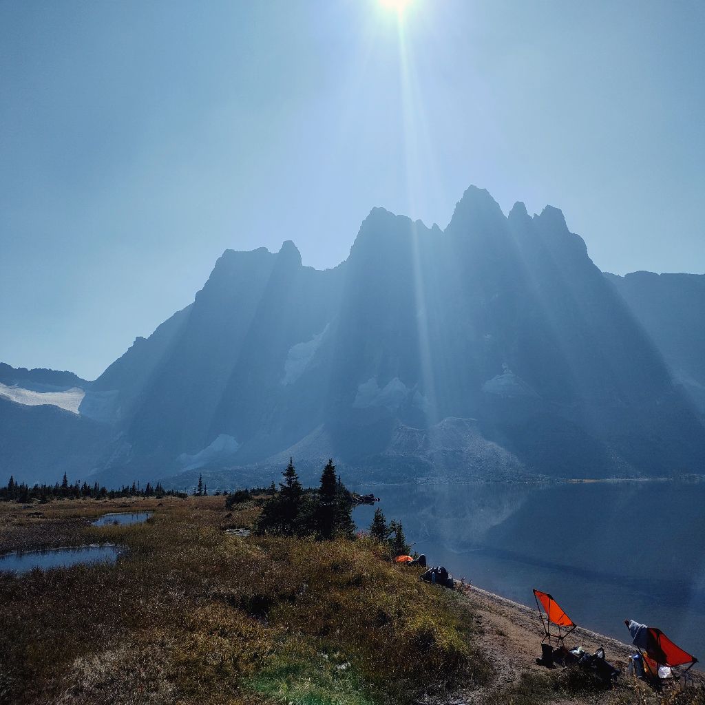
This was actually a busy area! A couple groups had stopped for lunch, and a few people had set up their backpacking chairs with their feet in the lake. (This is what conviced me to buy a chair for next summer LOL) It was above 20 degrees celcius so we waded in the lake, chatted with other hikers, and eventually went for a swim! The water is shallow and not as bone chilling as some glacier lakes can be. It was a lovely afternoon relaxing and enjoying the views. Eventually I laid down in the tent while Holly went for a wander. Then we reconvened for dinner, (Backpackers pantry came through again with one of our favorites, Pad Thai.) and eventually enjoyed our apple cider while watching the sunset.
Day Three
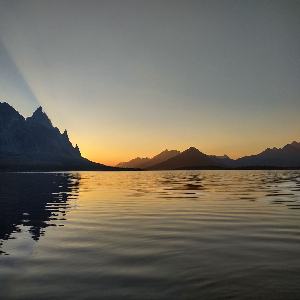
Luckily we got up early, and happened to make our coffee in time to watch the sunrise! It hadn’t occured to me to check before starting the hike, but I would check what time sunrise is and set an alarm next time, you really don’t want to miss it. Then we started packing up and making breakfast. As we were cooking a caribou wandered through the campsite! We dropped everything, took some pictures, and then eventually had breakfast.
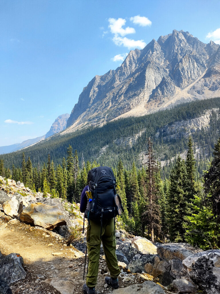
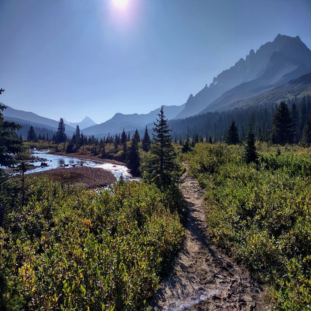
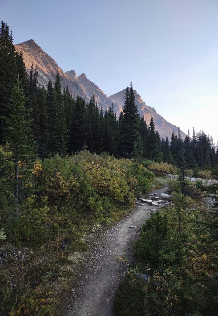
We started hiking out along the lake, crossing some streams and enjoying the last views of the rampart. Once we passed Macarib campground the trail turns and you start hiking up along a valley. You quickly hike above the treeline and spend the next few hours meandering along a creek, looping back and forth over it as you continue to climb.
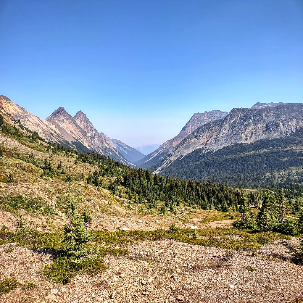
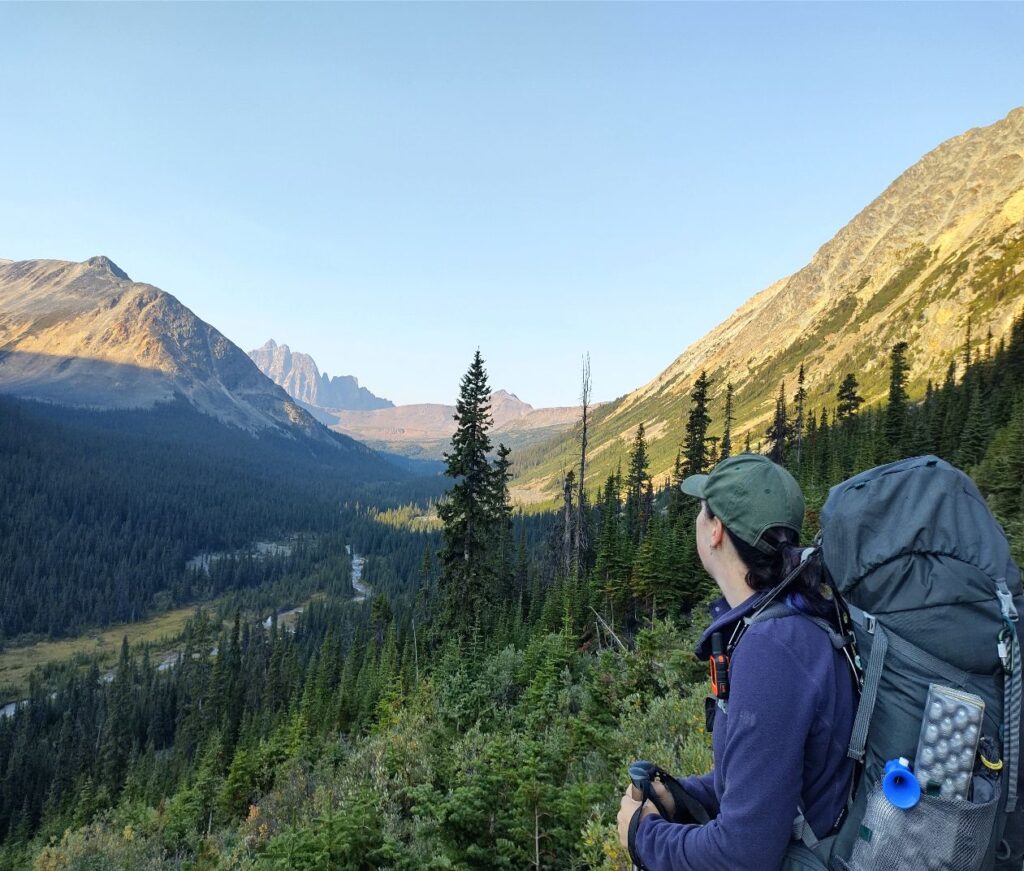
We stopped for lunch with another group of hikers, and took off our boots, putting our feet in the stream. After our break we continued hiking higher up a gradual but steady slope. The views were spectacular, and eventually we reached the highest point on the trail!
We stopped for another break, and took many, many photos. They really can’t do it justice at all. We were surrounded by mountain peaks, and looking down along the valley we would hike out along. Eventually we hiked down the trail, finding another creek that we would follow to the last campground on the trail.
Campground Number Three – Portal
The sign for Portal campground finally appeared after our second longest day of hiking and we were happy to see it. The campground is basically right off the trail, no long trek to get there. The Portal campground initally is a little more run down and much smaller. Bonus though the picninc tables are right next to the bear lockers! Then the tent pads are set going slightly uphill. It’s not much to look at, but from the picnic tables the views are actually really pretty! The tent pads were not very clearly marked, and we never did figure out how many there are supposed to be. (The answer is 4) We shared this site with the same group we had lunch with!
We got set up, had a snack, and then wandered down across the trail to the creek. You can hear it from the eating area, and it was lovely. We sat and enjoyed the cold water on our feet, and I even read my book for a bit. Eventually it was time for our dinner, which sadly was a bit of a let down. It was supposed to be a lentil stew, but it was watery while the lentils were hard? So we enjoyed our excessive amounts of trail snacks instead, and had some protein bars as well. (Another good reason to pack extra food!)
Day Four – Trailhead
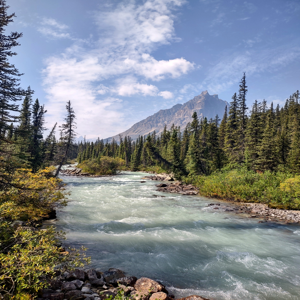
Our last day on trail started with the dawn again, and we enjoyed our breakfast in the chilly morning air. We even saw a mother deer and her baby! They were passing by the creek. Then we packed up and hiked out. The trail is following along the creek, but you do spend a bit of time climbing up the side of the valley before dipping back down. You cross another rockslide at one point as well. We enjoyed watching the sun rising as we hiked, and the changing colors of the sky.
As you follow the creek it gets bigger and more intense, until it becomes a full river almost. It makes for a slightly wet trail and a nice mist while you hike. After a few hours we made it to the traihead before noon. Then we changed, had a snack, and headed out.
We had a very exciting stop planned for the way home! Outside the park gates, just before Hinton is Folding Mountain Brewery! The have THE BEST gluten free fried chicken sandwhich with hot honey. I’m obssessed no joke. Holly likes the beer so we had planned a little treat for the way home. Not gonna lie, I ate 2 sandwhiches and justified it by saying I hiked 43 KM.
Itinerary
Here’s the route we took this year:
- Day 1 Astoria trailhead to Switchback campground 13.8km
- Day 2 Switchback to Amethyst campground 5.7 km
- Day 3 Amethyst campground to Portal campground 14.2 km
- Day 4 Portal campground to Portal Creek trailhead 8.7 km
Things to consider when booking, there’s actually 2 different trails you can take for the first half, with different campground options. They meet up after Switchback campground, before Amythest campground. The trails are notorious for being muddy, so I planned to hike at the end of August, when it would be driest. (This is also the most popular time.) We actually saw the start of fall colors and had frost in the mornings so be prepared for that. The campgrounds I chose had the nice side effect of having a long day, and short day, a long day, and then a final short day. It made for easy days, and we had a lot of time to hang out at Amythest lake and enjoy the views.
Here’s the route I would take next time:
- Day 1 Trailhead to portal 8.7km
- Day 2 Portal to Amethyst 14.2 km
- Day 3 Amethyst to Portal 14.2 km
- Day 4 Portal to trailhead 8.7 km